![]()
A Return To Beauty . . .
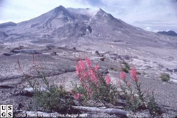
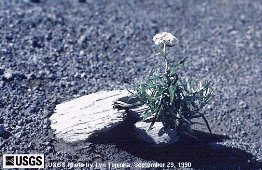
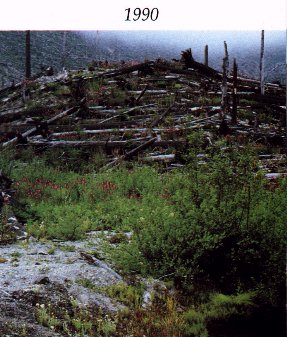
photo by Lyn Topinka, USGS
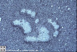
Despite the devastation left behind on May 18th, not everything in the blast zone was destroyed. Areas that seemed like they would never recover have surprised scientists with the resilience of nature. Many animals and plants who were fortunate enough to be beneath the spring snowpack or underground, soon found their way through the thick ash to the surface. Several lakes that were still frozen over went virtually untouched even though all the life around them was decimated. One of the first plants to reappear, appropriately enough, was the fireweed (pictured above). The presence of plant life enticed deer and elk to return to the area. With their wanderings, they stirred up even more ash, freeing seeds and shoots of plants still buried. Even though there were over 1500 elk killed as a result of the eruption, the elk population had returned threefold by the early 1990’s thanks to mild winters, an abundance of food on the debris avalanche, and the lack of human interference.
This is the remains of one of the Weyerhaeuser logging camps. The spots of yellow are the remains of logging trucks that were tossed like toys by the mudflow. |
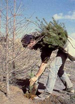
One of the hardest hit industries was logging. Weyerhaeuser lost approximately 60,000 acres of trees. Logging camps, buildings and equipment were also lost or damaged. Many of the trees near the mountain were a total loss but much of the forest blown flat in the lateral blast could be saved. By November of 1982, the Weyerhaeuser company had recovered enough blown down trees to build 85,000 three bedroom homes. After the recovery came the daunting task of planting, by hand, more than 18.4 million trees over 45,500 acres. Test plots showed that normal survival and growth could be expected as long as the ash was scraped away so the seedlings roots could be placed directly in the mineral rich soil below. |
|
Plants outside of the tree farms have had a fairly easy time returning to the area. Millions of seeds are blown into the devestated area from the surrounding forests. Erosion caused by wind and water freed small plants that had been buried under the snow pack and droppings from the elk herds contain seeds and vital nutrients, prompting other plants to grow. Alder and willow trees grow easily in nutrient poor volcanic deposits and provide shelter for other plants.
![]()
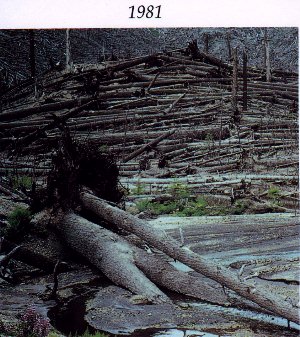
The two pictures below were taken from the same place approximately two years apart. From this perspective the mountain is off to the right. Notice in the 1981 picture, the slope on the right hand side facing away from the mountain was fairly well protected from the intense heat of the lateral blast.
|
|
Coldwater Valley Overlook in 1979 |
Coldwater Valley Overlook, Summer 1981 |
![]()
 |
 |
both photos above were taken by Jim Quiring, U.S.D.A. Forest Service
While Mt. St. Helens may never be the same again, she's doing her best to cover the scars. On August 26, 1982, Congress established the area around the mountain as the Mt. St. Helens National Volcanic Monument. An area of about 110,000 acres has been preserved so it can heal without any human interference. While there have been several Visitor Centers built along the new highway into the blast zone, guests are expected to leave the land as they found it. In essence, the monument has become a living laboratory in which scientists and the public can observe the amazing return of life to the area.
![]()
|
The only thing permanent is change. Here at Mt. St. Helens the process of creation is never complete and we have the opportunity to witness nature's power first hand. It is important to remember that Mt. St. Helens is still quite actively working to rebuild herself. Her sleep is fitful at best. We can only watch and wait for Loo-Wit to sing again. |
|
![]()
|
The rivers ran thick with liquid earth and
mighty forests were brought to their knees. And the air was filled with the roar of a
thousand battles, the dust of a thousand armies. -David Hoole, Washington the Beautiful |
![]()
Pages designed May 1998 by Valerie A. Smith. Please send all
questions, comments and suggestions to valerie@olywa.net
Thank you to the USGS and other featured photographers. Without the photos, these
pages would not be possible.
This page last updated
June 06, 2006.